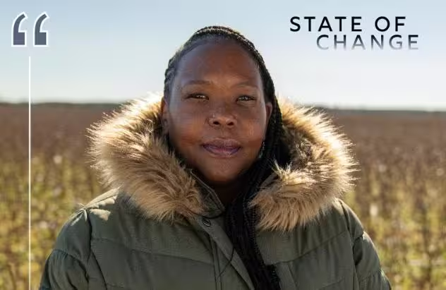
State of Change: Living with Water
Special | 26m 46sVideo has Closed Captions
How communities are returning waterways to a natural state to address the impacts of climate change.
Learn how NC communities have increased their resilience to climate change by returning waterways to a natural state. Stories include how the Battleship North Carolina modified its marshy surroundings to adapt to rising sea levels, how Conserving Carolina is working to restore floodplains in western NC and how the Coharie Indian Tribe is reconnecting with the river they’ve lived on for centuries.
Problems playing video? | Closed Captioning Feedback
Problems playing video? | Closed Captioning Feedback
State of Change is a local public television program presented by PBS NC
State of Change is part of the Pulitzer Center’s Connected Coastlines reporting initiative. For more information, go to https://pulitzercenter.org/connected-coastlines.
State of Change: Living with Water
Special | 26m 46sVideo has Closed Captions
Learn how NC communities have increased their resilience to climate change by returning waterways to a natural state. Stories include how the Battleship North Carolina modified its marshy surroundings to adapt to rising sea levels, how Conserving Carolina is working to restore floodplains in western NC and how the Coharie Indian Tribe is reconnecting with the river they’ve lived on for centuries.
Problems playing video? | Closed Captioning Feedback
How to Watch State of Change
State of Change is available to stream on pbs.org and the free PBS App, available on iPhone, Apple TV, Android TV, Android smartphones, Amazon Fire TV, Amazon Fire Tablet, Roku, Samsung Smart TV, and Vizio.
Explore More from State of Change
Hear from North Carolinians about climate change effects & innovative solutions across the state.[light upbeat music] - [Announcer] Quality public television is made possible through the financial contributions of viewers like you who invite you to join them in supporting PBS NC.
[soft ethereal music] - [Ryan] Water gives and it takes.
It is the source of life for everything around us.
On the other hand, we know that it can create violent floods and disaster.
- During Helene, the water was 12 to 15 feet above our heads right here.
- Here in the Southeast, climate change is making the water cycle more extreme.
Low flows on rivers are becoming lower due to drought.
High flows are becoming higher due to tropical storms and hurricanes or even just intense thunderstorms.
That variability can have negative impacts on vegetation, fish, and wildlife, and it can have serious implications for humans who live near these rivers and streams.
- We had flooding events 147 days of the year.
If people can't get to our ship, then our business model is threatened.
- [Ryan] It's critical that we pay close attention to climate change and its impacts on rivers, wetlands, and other watery places throughout North Carolina.
- How do you clean out a big river?
The storms had downed trees.
The overpopulation of beavers had dammed up the run.
The water weren't flowing.
- [Ryan] We may not be able to stop the changes that are happening as a result of climate change.
We may not be able to mitigate these changes.
But by close observation, we can get a better sense of what steps we can take to continue living with the river despite its changing nature.
[soft ethereal music] - Conserving Carolina is a regional land trust based in Henderson County, which is in the mountains of Western North Carolina.
- We are at Pleasant Grove, which is a restoration site along the French Broad River in Etowah in Henderson County.
And it is one of a chain of restoration sites that Conserving Carolina has been working on throughout the French Broad River Corridor.
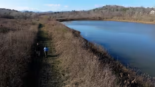
Places like this can give us a more resilient landscape that is better able to handle the blows of a changing climate.
They protect our communities during flood events by giving the water a place to go that isn't destructive, a place where it can spill over and it's meant to spill over.
And these floodplains hold really huge amounts of water.
- [David] And then we also do a lot of creation of wetlands and excavating floodplain pools in order to store water in those dryer dries that we expect to see.
- If you're not sending all of the water straight into the river channel and just like telling it, "Goodbye, you know, downriver," then it stays here, it stays here for a while.
Historically, in the last couple of hundred years we really changed the way the river works.
- The history of the French Broad River is similar to many rivers in the Eastern United States, in that they were dredged out and straightened to some extent to allow for boat traffic.
- People moved water off of the land with ditches, they built berms along the side of the river, and the whole idea was to have like the land be the land and the water be the water, and the river is just gonna run in this channel.
And if that's all you're used to, then maybe that's what you think like a river is.
It's just a line, a line of water that moves through the landscape.
But really it would be like a broader corridor of wetland.
- [David] Our ultimate goal is to restore that hydrology and keep as much water on the floodplain as possible.
- [Greg Je.]
The type of engineering that we do here is focused on the natural environment.
This entire property was a golf course until 10 years ago.
- [Rose] This beautiful creek used to be a deep ditch.
You know, it wasn't picturesque, and it wasn't that great for wildlife, and it also caused a lot of erosion.
So there was a restoration to bring the creek back to a healthy natural state.
- We have a whole series of wetland cells that are throughout the property.
This whole eight acres of wetland developed by plugging a ditch up.
- There were already on the site two ponds.
So one of those ponds is still there as a pond.
And the other pond, we dug a channel connecting the pond to the river, and that creates a backwater slough.
Sloughs would've once been common along the French Broad and were largely eliminated from the Upper French Broad River Corridor, to the extent that it's not really even a word that people are that familiar with.
So slough is a word that we have to kind of introduce people to.
S-L-O-U-G-H.
So if you see the word written out, now you know how to say it.
- We have seven acres of water that is still water, but it's connected to the river so the fish can easily come in and out.
And they have lots of room up here.
And the muskie in particular being such a large fish.
- Muskie are a big, toothy fish.
They're an apex predator that is native to the French Broad River.
They get well over 35 inches, and we've caught 'em up close to 50 inches.
- The population declined to the point that, in 1970, the Wildlife Commission started stocking muskie.
- Muskie have really specific spawning requirements.
Their eggs aren't sticky like some other species.
And so when they spawn, they kind of just lay on the bottom.
So these slack water areas are important.
- [Scott] It allows them to get off of the conveyor belt to a less stressful environment to spawn and go through that egg development in early life stages.
- All of the muskie that we've stocked from 2018 through 2022, all were implanted with a little PIT tag, which is very similar to what you had put in like your pet.
- The tag is like their Social Security Number.
When the fish swims across the antenna, the antenna talks to a little copper coil that's inside this glass tag.
So we know who they are, when we tagged them, where they came from.
- Just in this slough at Pleasant Grove, we've detected 29 muskie.
The detection equipment's been active since May, 2023, and so that's a little less than a year and a half.
That's actually quite a lot.
So we're pretty excited about that.
[light upbeat music] - [Rose] We're all part of nature, so like what's good for nature is also good for human beings to flourish.
- [David] At our Dodd Meadows Restoration Site, we restored about 1500 linear feet of stream, and we had the opportunity to also install a multi-use walking path adjacent to that stream.
That's really important because, right next to this site is a pretty large Habitat for Humanity community with a lot of residents.
- Before Conserving Carolinas came in, that was not somewhere you wanted to go.
It was a straight line, it was deep, debris would go down in there, it was full of lots of trees and trash.
It was just not a place to go, not a place to go walk, not a place for children.
It was really beyond our expectation, what we wound up with.
We have families that go down and walk on the trail, children play in the creek.
The mental health of children when they have greenspaces, it's 55 to 60% better as adults.
So it's really a great, you know, surrounding of the community.
- Seeing the power of nature just doing what it does best is really inspiring to me.
To know that we can go in and make some of these minor changes to the land and then see it become its fullest is just super exciting.
[soft guitar music] - In the last five years, we've had a really strong focus on restoration projects.
So within that period of time, we completed the Mouth of Mud Creek Restoration, which was the first large-scale natural floodplain restoration in the mountains in North Carolina.
It was kind of a new thing that we tried, and we've seen like really good results on all kinds of levels.
And what we've seen too is just so much interest.
As soon as people could see, "Oh, the riverside property could be like this," there were a lot of people that were like, "My property also has this potential."
- [David] I think part of the reason that that's true is because there are so many benefits to these projects.
- [Rose] Once you start to have like this growing network of natural floodplain areas along the river corridor, I think you really can imagine a French Broad River Corridor where restoration is widespread and these kind of habitat areas are common along the river.
[soft guitar music] [soft electronic music] - We are in Wilmington, North Carolina, and behind me is the USS North Carolina.
Battleship North Carolina is berthed on Eagles Island immediately adjacent from downtown Wilmington.
Commissioned in 1941, it was the first of America's fast battleships designed and built for the coming World War II.
Battleship North Carolina was the first major ship to enter Pearl Harbor after the bombing.
It did see action in every major event in the Pacific Theater, from six months after the bombing of Pearl Harbor to the signing of the treaty with Japan.
The Navy, in the late '50's, started to begin to decommission and sort of move ships off its rolls.
And that's when the Navy contacted representatives in North Carolina and said, "This is your opportunity."
There were a group of North Carolinians who were very, very interested in bringing the USS North Carolina home to its name state, and they launched a statewide campaign.
One of the groups that they reached out to were school groups, and part of the campaign was, if school children donated their pennies and nickels and dimes and every child in your school donated, then all the children in the school received a free ticket to the Battleship North Carolina.
And that created kind of the first wave of visitors to the Battleship North Carolina.
It also created a passion for the ship and a love of the ship.
[ethereal electronic music] We're at an interesting place where a lot is happening in terms of hydrology.
- Something that's really unique about this area is, where we currently are standing, we get both discharge from the Lower Cape Fear River, and we're low enough in the estuary that we get semi-diurnal tidal influence.
So we have two high, two low tides a day that influence this location.
So we have this confluence of river flow and tidal flow happening right here.
In coastal areas like this, we have, honestly, a multitude of potential impacts from climate change, one of the most obvious being increased flooding from things like sea level rise or changing frequency of storm impacts.
- We're on the river, so we see the river every day.
And the conditions of your environment then becomes something that you almost unconsciously track.
And around 2015, leadership noticed that there was a change in the river.
And what was occurring, what was changing was an increased frequency in tidal flooding.
I have an academic background, and so I decided to do a trend analysis to find out how much the flooding may be changing over time.
- Under the Cape Fear Memorial Bridge, they've been monitoring water level and therefore tides for over a hundred years.
It's one of the longest running tide gauges in the state of North Carolina and, in fact, in the Southeast.
- NOAA realized that the conditions here at the site exactly mimic the tidal conditions at the tidal station at the foot of the Cape Fear Memorial Bridge.
So the tidal record at the bridge was a database that I could use to determine if the tide's impact was getting worse, and, if so, by how much.
I did a historic trend analysis.
The results showed an over 7000% increase in tidal flooding since the battleship arrived in Wilmington in 1961.
- Yeah, we went from double-digit tidal flooding in the '40's, '50's, and '60's to then triple-digit.
In terms of operations, our road was being flooded, sometimes very severely, and sheet flooding across the water was moving across the road.
It wasn't stable, it wasn't standing still.
Our parking lot then would often be flooded.
Because we're required by law to operate under revenues generated through ticket sales and gift shop sales, if visitors can't get to our site or are not comfortable parking once they get here and they turn around and leave, then our business model is threatened, and ultimately we will not be able to be sustainable financially.
So there was a real economic impact to our operations and the survival of the ship.
[light playful music] The leadership really decided to go an innovative way with living with water.
Rather than doing kind of standard bulkhead and wall building to try to keep the water out, we decided to do nature-based infrastructure.
Living with water really has four components.
One is the installation of a living shoreline in areas where the shoreline had been hardened.
The second is the installation, the recreation of a wetland area that has not been there for many, many decades.
The third piece of it is the elevation of the remaining parking lot area.
And the fourth piece is education.
- This project is honestly one-of-a-kind in the state.
The fact that this is several hectares, several acres of property that they are proactively creating this resilience and flood mitigation project on is almost unheard of.
I am one of three different research labs at the university.
We are monitoring a series of stations for multiple things across the whole site, mostly to examine what the baseline conditions were, so what everything started at.
We've been able to continue the monitoring through the construction process.
That is actually a piece of the science that is a big unknown.
And then several years after, to look at the potential long-term impacts.
It provides this incredible local opportunity for students to be able to come out here, be involved in a applied community project, and also collect data and learn skills that they can apply to, you know, a future professional career.
- We're not unique in these impacts and in our circumstances.
There are many communities along the coast who are similarly being impacted by rising seas and tidal flooding.
And we realized that we had an opportunity to install some unique aspects to manage our tidal flooding and to document how well they are working.
We take that role seriously in terms of being able to provide a model to other communities.
- This is one of the first and largest projects to incorporate all of these different components in one site.
And that kind of holistic approach is what we need going forward.
That's the only way to tackle these kind of big-picture problems is from a holistic view.
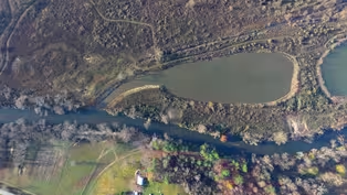
[light playful music] [soft ethereal music] - The Great Coharie River is a braided stream in its headwaters, and that means that the stream has multiple channels.
If you look at it from overhead, they sort of intertwine and weave in and out of one another.
That is a common characteristic of streams that flow through sandy areas like Sampson County.
Here in the Southeast, climate change is making the water cycle more extreme.
In Eastern North Carolina, that is no exception.
Rivers like the Great Coharie are also subject to these extreme flows, and we've seen this in recent years through floods that have come with hurricanes.
They've also had very intense droughts in the region.
and those swings between high and low create all kinds of challenges for people and for the river itself.
[soft ethereal music] - The Great Coharie River Initiative started with a simple premise of just gaining access to the Great Coharie River here in Coharie land.
The land down south of here on the other side of Clinton, the water systems down there, they're open, the river flows free.
But up here it was clogged with debris.
- The storms had downed trees.
The overpopulation of beavers had dammed up the run.
The water weren't flowing, it was backing up on agricultural soil.
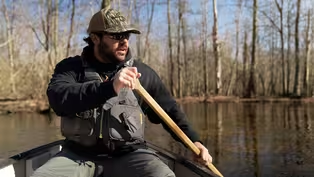
- From the perspective of Coharie people, a healthy river is one that has constant interaction with people, through paddling, through fishing, through swimming, and just being close to the river.
And because the river was closed off to them for so many years, it had devolved into an unhealthy state.
And so one of the early aims of the Great Coharie River Initiative was to clear a path through the river channels so that people could once again paddle this beautiful blackwater stream.
- The crew that we used or talked in to help us was our drum team.
We just asked 'em, "Look, can y'all come help us Saturday "clean out a section of the river?
"And it's gonna be dirty and nasty, "but we'll have a good time.
"We could feed you, but that's all we could offer you."
The first three or four Saturdays that we worked, we cleaned out probably about a mile of river.
Out of those eight young men, the first day we started, there was only one that had a full-time job.
And what I noticed about that same group, the second year when they came back, there was only one person that didn't have a job.
So we saw something that came alive there that made a difference in a group of young men in our community.
- I'm not so sure that we've helped that river as much as it has helped us.
This awakening that's taken place, it's come into our community.
So many more people participating, so many more people being responsible.
We know the importance.
And that's gonna be passed down from generation to generation to generation.
- The greatest change that I've seen has been in our young folks.
The drum team has gotten bigger.
We have culture classes here now.
We have younger folks that have grown up through this Great Coharie River Initiative era who are participants in those classes.
[rattles shake] - [Greg Ja.]
This canoe here that we have in our museum is 600 years old.
And as we have returned to our responsibility of debris removal in the rivers of Sampson County, it was found over in South River.
So in my mind, it's like we're being responsible.
Now we're being the people that we should be, and maybe it's proud of us.
So it decided to show its face and come back to this cultural revival.
[musicians chant] Kullen is one of our best examples that got a way away from home.
But once he was introduced back into that, something spoke to him that changed him forever.
Now you can't get him to stop.
Something that was lying dormant inside of him, that river tapped into it, and it sprang up.
- I'm gonna go way back.
I was born in 1993.
Growing up, I remember hearing stories from my grandpa, my dad, about fishing down in our water.
The Daniel Hole, which is actually Mr. Philip Bell's dad's, my great-uncle Daniel Bell.
And it's where a lot of food source came from for our people.
The first time I was introduced to the waterway was around 2015, 2016, and I was like, "This is insane, "this natural resource in my backyard "that I wasn't able to enjoy as a kid."
Then when I got more involved and we created the Coharie River Tours, it just helped me slow down.
I was living in Wilmington, North Carolina, and that's a fast-paced life.
Just helped me slow down and, really, when I'm out here on the river, think about what's important and what I want in life and thinking of legacy and what you can do for your community.
I wasn't very involved in the culture growing up.
Once I got involved with the river, I remember I went to my first drum class.
I just remember that first time drumming with all, you know, mostly family members, that feeling I got from it.
I've never been able to put a finger to it.
It was just a good feeling.
- [Ryan] Coharie and Lumbee and many other Indigenous peoples in the Southeast especially share names with rivers.
That is how our people identify.
Our rivers have a very strong spiritual and historical connection that involves their role in protecting us during early waves of colonization.
- When I go down that river, I can imagine my ancestors looking for a place of belonging, a place that was safe that they could raise their families, and I can feel people doing whatever they got to do to survive.
But the beautiful thing is that I can feel the satisfaction of when they came to the Coharie River.
Here's where we stopped running.
So here it is, 2025, and we're still on the banks of the Coharie River.
It bears our name, and we love it, we're gonna take care of it.
- Indigenous peoples are observers of their environment, and they have been since time immemorial.
They are scientists, technicians, philosophers, and they carry this deep knowledge.
It's not always recognized in the ways that we recognize it in academic spaces, but that doesn't make it any less valuable.
The story of the Great Coharie River Initiative is important because it shows how Indigenous peoples can not only take the stewardship of the environment into their own hands, but, when they do, amazing things can happen.
You can have healthy ecosystems, you can have people who are learning what it means to be in close relationship with water.
- It doesn't have the same uses as it did to our ancestors, but it's still important to keep it maintained.
And I have tons of ideas on more of like your 10- to 15-year plans on what this place could look like with proper care.
[soft ethereal music] - [Rose] I think a lot of times when we look to the future, we have so many things to worry about.
We have so many things that are not going well, right?
But you can also look toward things that are going well, that are getting better, that are like hopeful.
And the more we do of that, the better world we'll live in and the better world that we'll pass on to our children and grandchildren.
- Whether we think about the mountains and the potential for landslides and flash floods or whether we're thinking about the coastal plain and these issues with droughts and floods there or whether we think about our coasts and sea level rise, erosion, and the transformation of coastal landscapes, we have to pay attention.
And only by paying close attention, observing, being out in these landscapes, can we truly get a sense of what local measures are needed in order to continue living in these places that are so important to us.
[soft plaintive music] [soft plaintive music continues] [soft plaintive music continues]

Battleship North Carolina: Living with the Tide
Video has Closed Captions
Tidal flooding skyrocketed at Battleship North Carolina. Natural systems may be the key to survival. (7m 50s)
The Coharie Indian Tribe: Returning to the River
Video has Closed Captions
The Coharie Indian Tribe's restoration of their namesake river prompts a cultural awakening. (8m 42s)
The French Broad River: Fixing the Floodplains
Video has Closed Captions
Restored floodplains absorb and hold water, building resilience to climate change in Western NC. (8m 50s)
Preview | State of Change: Living with Water
Video has Closed Captions
How communities are returning waterways to a natural state to address the impacts of climate change. (1m)
Providing Support for PBS.org
Learn Moreabout PBS online sponsorship
- Science and Nature

Explore scientific discoveries on television's most acclaimed science documentary series.

- Science and Nature

Capturing the splendor of the natural world, from the African plains to the Antarctic ice.


Support for PBS provided by:
State of Change is a local public television program presented by PBS NC
State of Change is part of the Pulitzer Center’s Connected Coastlines reporting initiative. For more information, go to https://pulitzercenter.org/connected-coastlines.